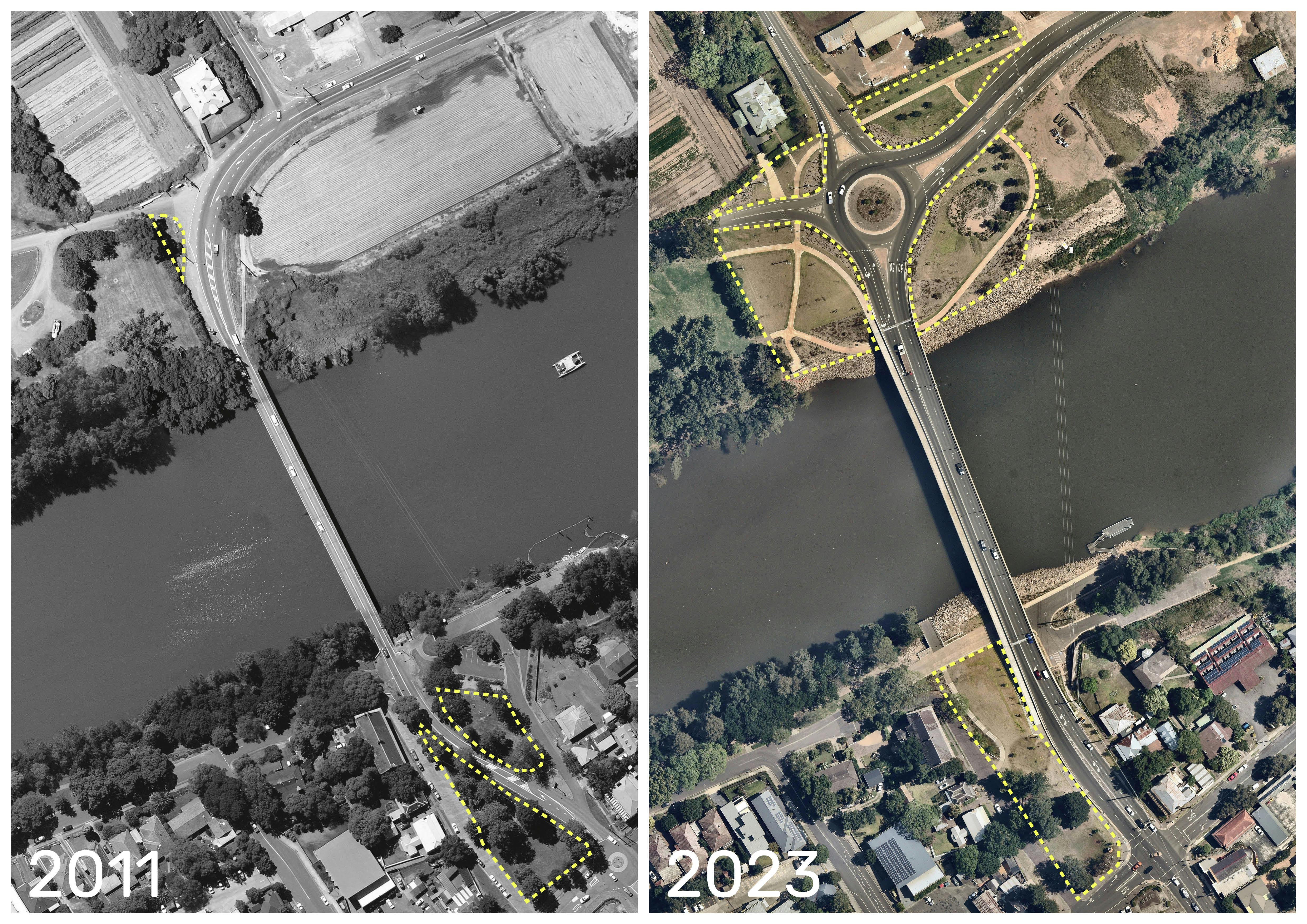
Narrow, with a short design life and originally built for horse-drawn vehicles in 1874, Transport for NSW needed to replace the Windsor Bridge and road approaches with a flood durable, new structure and approaches. The wider replacement bridge, 35 meters downstream, was controversial to many residents and stakeholders and a difficult planning and design challenge for the project team.
The project demonstrates how an urban design and landscape architectural approach to infrastructure can produce a functional infrastructure that connects people physically, while also providing an experience that is connected to the natural, cultural and historic context.
Over more than ten years the Transport Urban Design Roads & Waterways team and SMM worked together with the project team from planning to delivery, to produce a piece of transport infrastructure that provides a long term crossing for all vehicles and pedestrians, able to withstand floods, respects the heritage of the area, the landscape and community setting and leaves a legacy in the design of the Square, the bridge and its abutments, green infrastructure and active transport. The project supports economic growth and productivity by providing greater road capacity for forecast traffic volumes and safe two-way access for freight vehicles.
While Thompson Square has undergone change over the last 200 years, the heritage value of the site has been a key consideration in the urban design. The removal of the Bridge Street alignment across Thompson Square, re-establishment of the visual and physical connection between the town and the river, the partial restoration of the earlier landform and sympathetic choices of material and finishes reinforce the heritage value, while creating a new landmark structure along with numerous benefits.
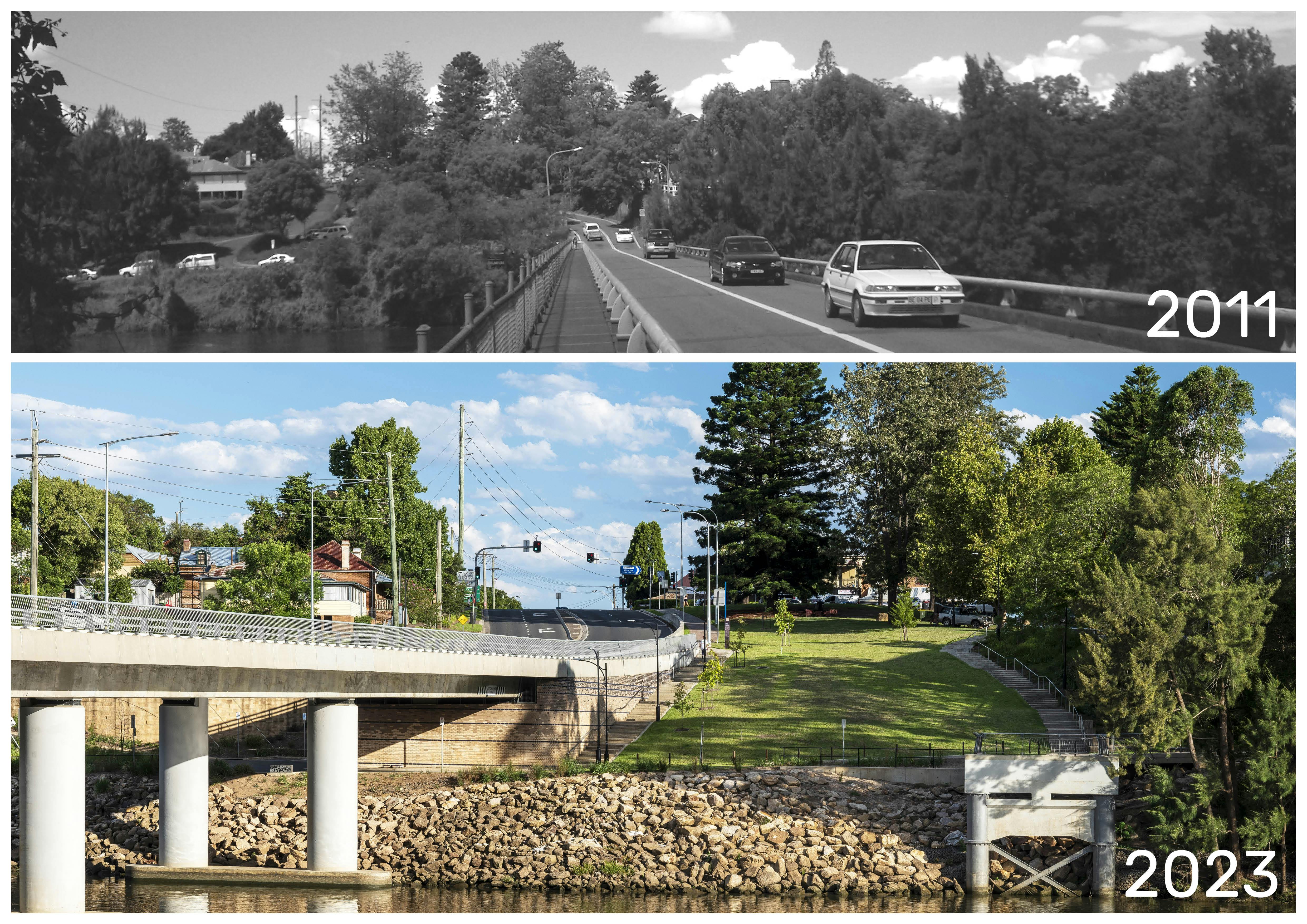
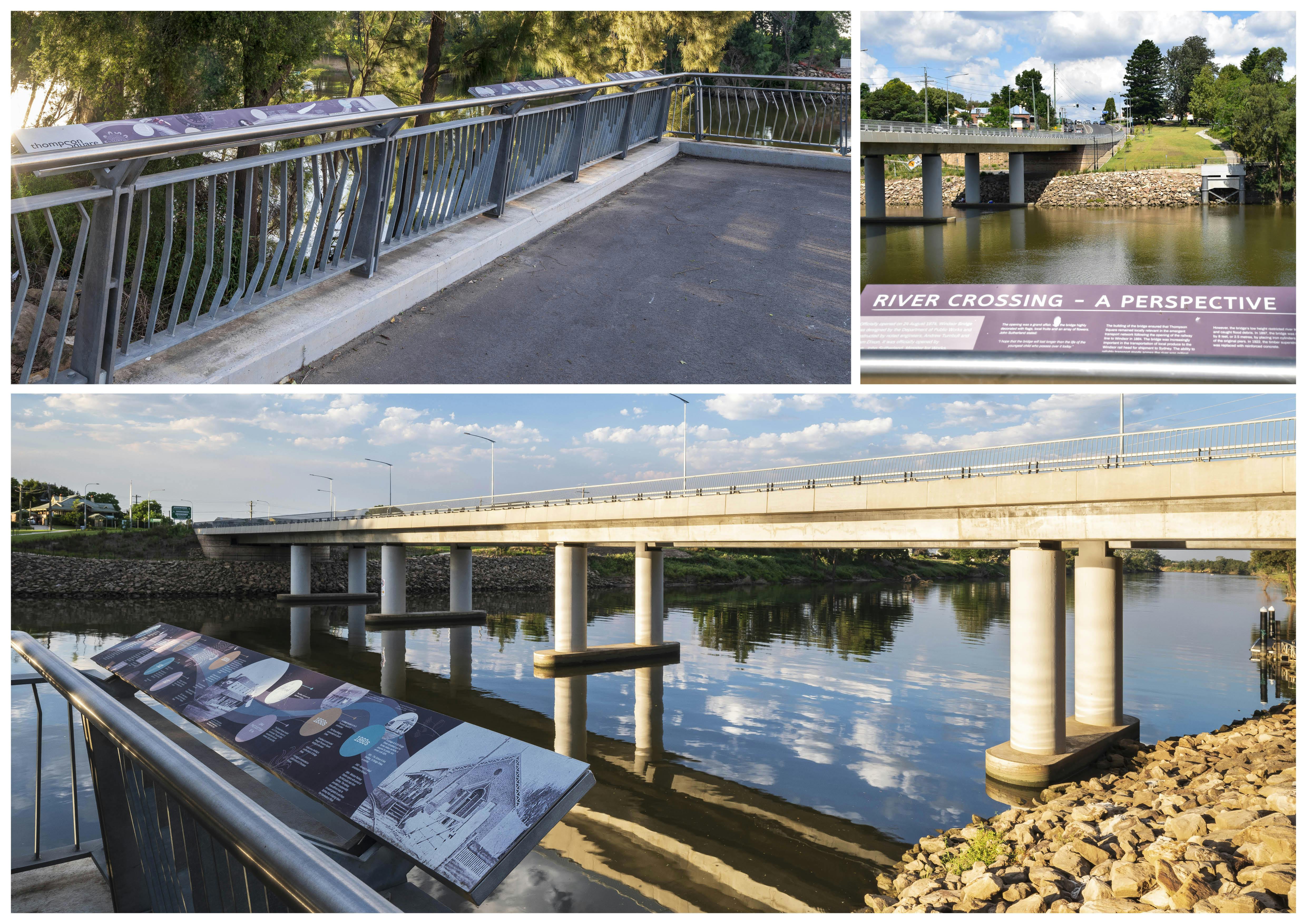
Amongst the benefits are an increase in usable green space (500 sqm), continuous connection from the top of Thompson Square to the river, enhanced views to the river and a viewing platform using the southern span, pier and abutment of the original bridge to acknowledge its heritage significance. A northern interpretation node also acknowledges the heritage and importance of the original Windsor Bridge and earlier punt operation.
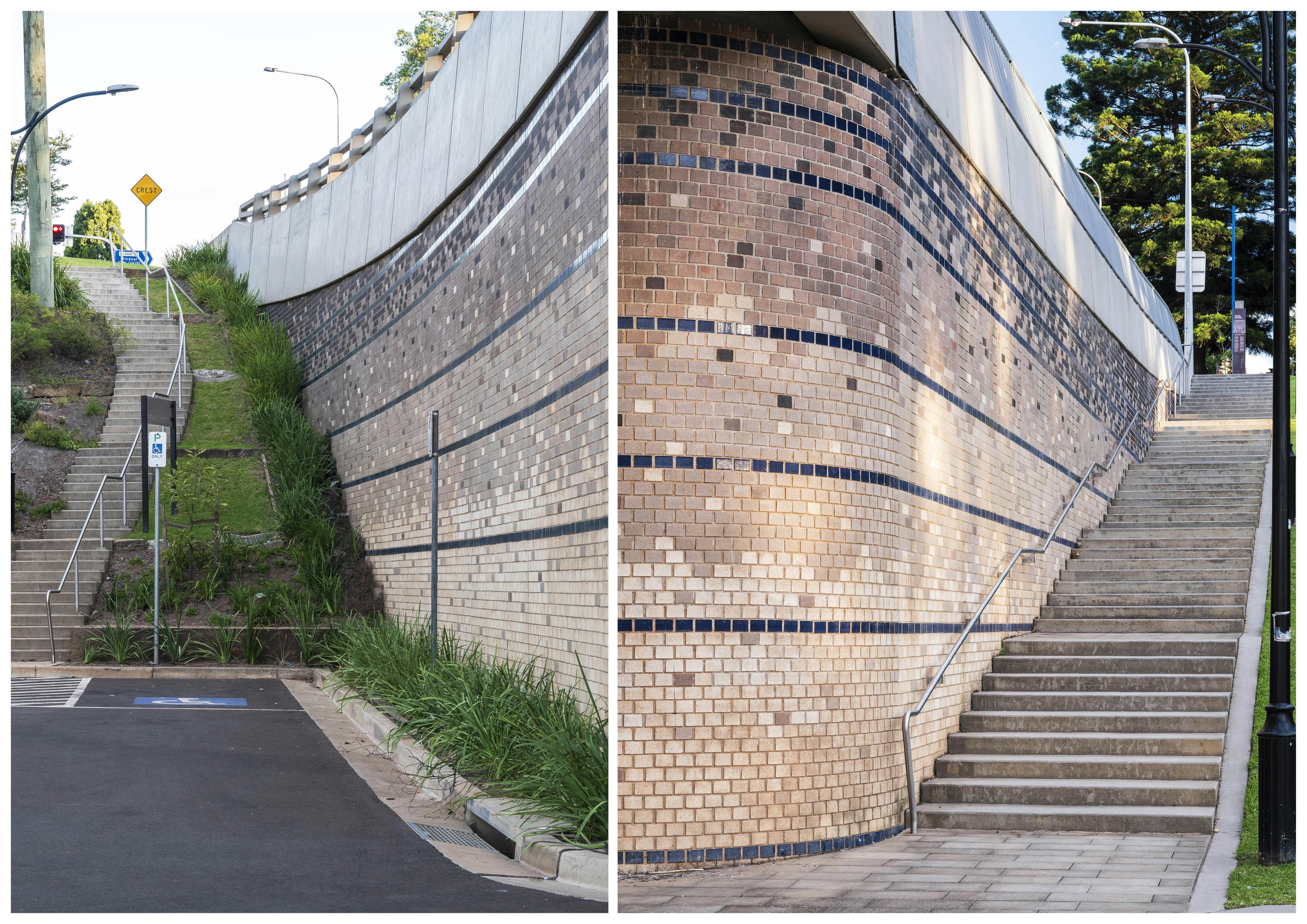
The bridge abutments are rounded to create a more open and generous space below the bridge, with a high-quality brick finish to reflect the materials of local historic buildings, while the brick pattern provides an interpretation of the flood cycles.
Materials and finishes have been selected for longevity, design life and best practice approach to sustainability. Selected materials unify the area’s sense of place and character, integrate with existing finishes, have a historic sensitivity, provide interpretation opportunities and are durable in terms of flood events and routine maintenance.
The new dual lane roundabout on the northern approach provides a safer, more free flowing intersection while the bridge abutment matches the finish and rounded corners of the southern abutment. A new network of shared paths link Macquarie Park with the riverside and to the shared path that crosses the bridge and provides direct access to Windsor.
WSUD has been integrated in permanent and planted water quality basins on the Northern side, capturing and treating stormwater runoff prior to being discharged into the Hawkesbury River.
The project has been inundated with three high level floods in the last year. The bridge and landscape have proved resilient with only bridge cleaning necessary and only smaller plants and mulching affected.
Since the floods, a combination of site-based learning and partnering with a local nursery have lead to future modifications to the planting palette, including a number of lower growing species that show improved tolerance to flooding. These findings will benefit revegetation in future bridge projects.
During archaeological excavations over 30,00 artefacts were recovered, from Aboriginal stone tools to maritime objects and discarded items of colonial life. An interpretation strategy formed part of the project, with a series of panels covering the sites rich Aboriginal, cultural and natural history and the conflict and devastating effects of colonial settlement on the Boorooberongal clan of the Darug people.
The project demonstrates how an urban design and landscape architectural approach to infrastructure can produce a functional infrastructure that connects people physically, while also providing an experience that is connected to the natural, cultural and historic context. This has been achieved through the iterative design process of the engineering components of the bridge and approaches, between the engineers, urban and landscape architects (SMM), heritage and cultural consultants and Transport’s Roads and Waterways Urban Design team.
